PURE NATURE – ACTIVELY EXPLORING

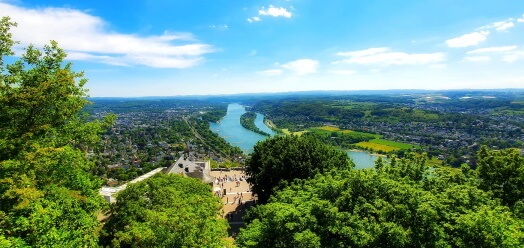
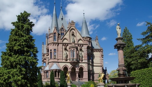
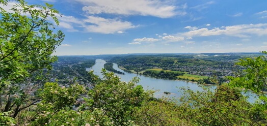
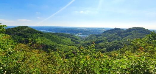
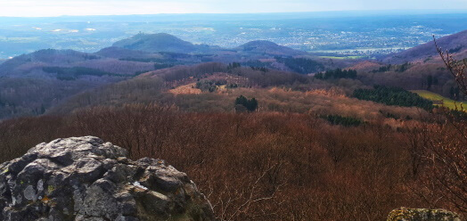
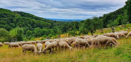
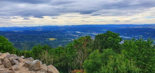
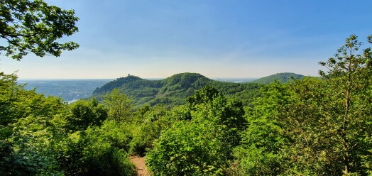
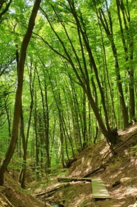
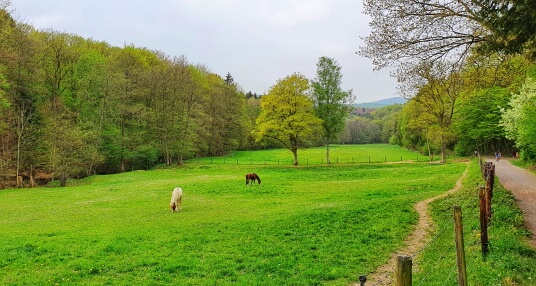
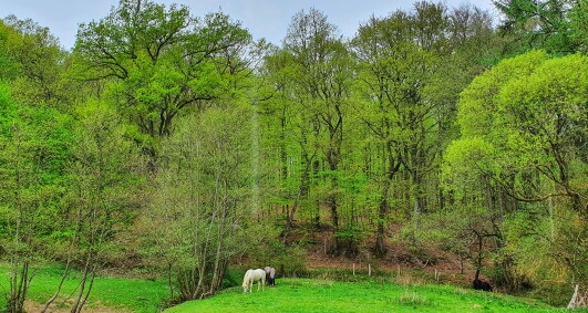
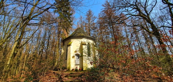
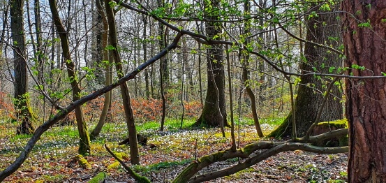
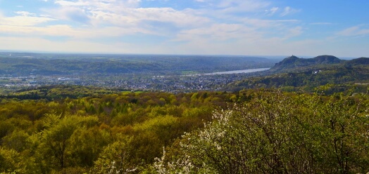
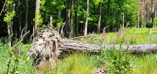
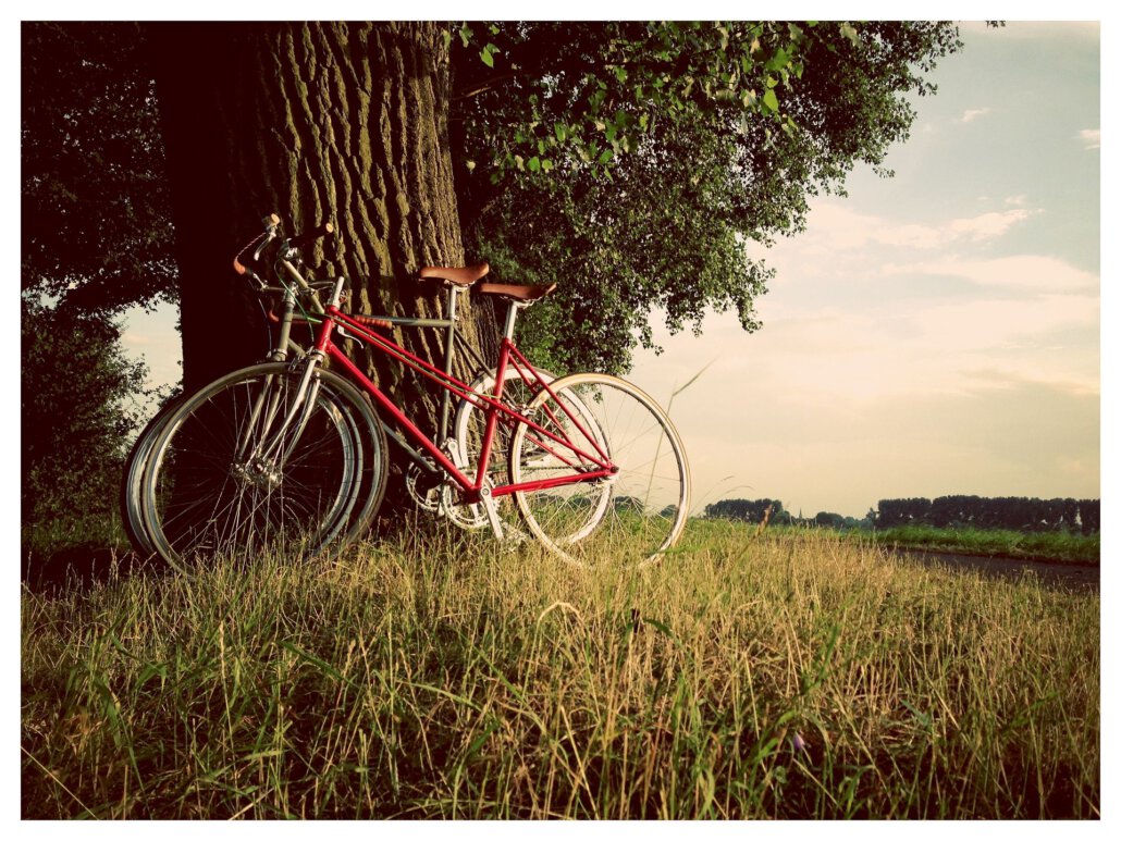
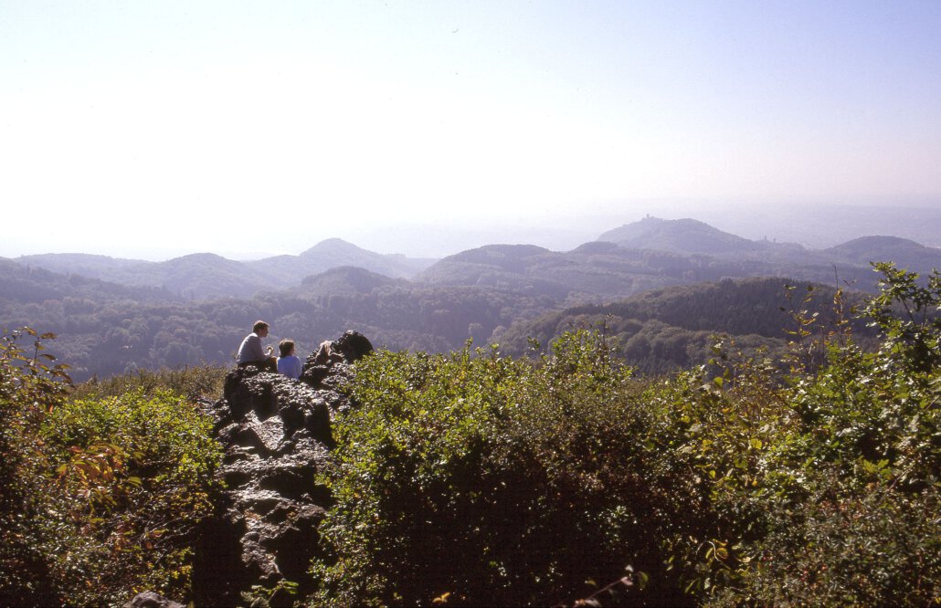
Whether in the Siebengebirge Nature Park, along the Rhine or even in the direction of the “Voreifel” or “Westerwald”, in Bad Honnef and its surrounding area, there is a lot to actively explore. Through the Siebengebirge Nature Park, in addition to the well-known “Rheinsteig” trail sections, many different hiking routes lead through deciduous and coniferous forests, past splashing creeks and repeatedly up to the peaks of the Siebengebirge with wonderful views. Along the river, the Rhine cycle path leads south to Linz or Remagen and north to Bonn. No matter if relaxed or very active – there is something for everyone here!

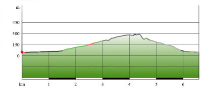
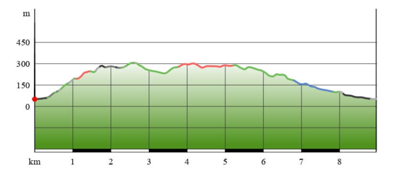
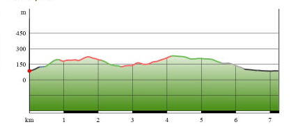
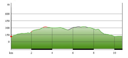
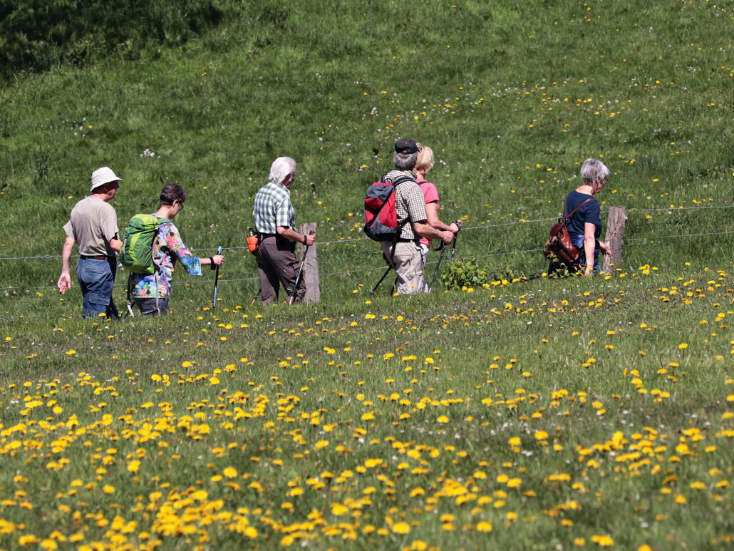
HIKING IN BAD HONNEF

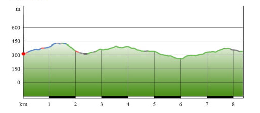
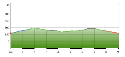
Bad Honnef is situated between the Rhine and the Siebengebirge Nature Park. The “Rheinsteig” leads directly along the edge of the town while various summits of the Siebengebirge offer incomparable views. So what could be better than to explore the nature park on the many hiking trails. We have put together some of the most popular hikes from Bad Honnef. However, this is only a small selection of all the possibilities to discover, there are about 200 km of hiking trails within the nature park.  Let`s begin, there is a lot to see!

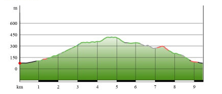
Map: Hiking recommendations in the Siebengebirge

You can also find more hiking suggestions in the area HERE

HIKING TRAIL RECOMMENDATIONS IN THE SIEBENGEBIRGE

Length: 6,6 km
Ascent/Descent: 244 m
Walking time: approx. 3:15 h
Start/End point: Ferry Königswinter
Significant waypoints, views:
Nachtigallental, Drachenfels, Drachenburg Castle, Nibelungenhalle
Rest stops: Felders Winzerhäuschen, Drachenburg Castle, Drachenfels Restaurant
Equipment: benches, shelters
Characteristics: classic beginner’s tour with architectural highlights

Elevation Profile:

Map-Download (pdf)

GPX-Download

The classic beginner’s tour! At the Königswinter ferry, which can be reached comfortably from Bad Honnef either by public transport line 66 or by walking and cycling, you first head in the direction of the “Nachtigallental”. Alternatively, you can park at the parking lot of the “Drachenfelsbahn”. Through the romantic “Nachtigallental”, the path now steadily leads uphill. We pass the “Hirschberghütte”, walk past meadow orchards and cross the path of the historic “Drachenfelsbahn”.

Once on the Drachenfels plateau, you have a wonderful view to the south of Bad Honnef, the Rhine with its two islands Grafenwerth and Nonnenwerth, and as far as Unkel. To the north you can see Bonn, and on a clear day even Cologne Cathedral.

A final climb brings you to the Drachenfels ruin, around which legends revolve that played an important role in the Rhine Romantic period.

Now the path leads only downhill. We reach Drachenburg Castle, which is certainly one of the most beautiful landmarks of the region. The castle, which prominently towers over the Rhine, was built in record time from 1882 to 1884 in the style of historicism.  A visit to the castle and its garden is absolutely recommended.

After the visit, we continue downhill and arrive at the “Nibelungenhalle” (Nibelungen Hall), a mystical place that offers insights into the world of the Nibelungen saga and also houses a reptile zoo. Along the so-called “Eselsweg” (donkey path) with wonderful views of the Rhine, we now head back down into the valley towards Königswinter. Be careful, the last part is very steep!


Length: 8,9 km
Ascent/Descent: 326 m
Walking time: approx. 3:15 h
Start/End point: Train station Rhöndorf
Significant waypoints, views:
Ulanendenkmal, Drachenfels, Drachenburg Castle, Wolkenburg, Geisberg, forest cemetery Rhöndorf with the graves of Konrad Adenauer and Peter Scholl-Latour
Rest stops: Restaurant Drachenfels, Milchhäuschen, wine bars Rhöndorf (Haus im Turm, Restaurant Chamai, Weingut Broel), Cafe Profittlich Rhöndorf
Equipment: benches, shelters
Characteristics: Classic highlights paired with lesser known viewpoints

Elevation Profile:


Map-Download (pdf)

GPX-Download

Starting at the train station in Rhöndorf, the trail first leads into the historic town center with its half-timbered houses. Passing “Ziepchensplatz”, we reach the “Ulanendenkmal” after a first steep ascent, built in 1925 in honor of those who died in the First World War of the Uhlan Regiment No. 7. From here we already have a first beautiful view of Bad Honnef and the Rhine. After a brief rest on a bench, we continue our hike through the shady deciduous forest on the “Rheinsteig” trail along the southern flank of Drachenfels up to the Drachenfels plateau.

Once on the plateau, there is a wonderful view to the south of Bad Honnef, the Rhine with its two islands Grafenwerth and Nonnenwerth, and as far as Unkel. To the north, you can see Bonn, and if the view is good, even Cologne Cathedral; Drachenburg Castle is directly in the line of sight.

A final climb brings you to the Drachenfels ruin which is rich in history.

Now the path leads from the stop of the “Drachenfelsbahn” a bit downhill. After a drawn-out curve, the path leads to the left in the direction of Drachenburg Castle, but we keep heading straight towards the “Milchhäuschen” (milk house). The restaurant, located in the middle of nature, is our next destination. A stop can be made in the rustic restaurant or on the sunny terrace. Now we are back on the “Rheinsteig” and follow it up to the “Geisberg”. After a last steep ascent, we are rewarded with a wonderful view of the Siebengebirge with the Drachenfels in the foreground. The Geisberg is also a part of the Beethoven hiking trail, which opened in 2019 and is well worth doing, in honor of the 250th birthday of this famous Bonn citizen and composer.

Now we start the way back. Past the shelters “Lieschenhütte” and “Kucksteinhütte” the path leads back to Rhöndorf in various serpentines. Shortly before entering the village, we pass the forest cemetery, where Konrad Adenauer‘s and Peter Scholl-Latour’s graves are located. The idyllic cemetery is definitely worth a visit.

Back in Rhöndorf, we recommend stopping at one of the local pubs and wineries! After all, the wine from the Drachenfels must be tasted.

Length: 8,5 km
Ascent/Descent: 320 m
Walking time: approx. 3:00 h
Start/End point: Parking lot Margarethenhöhe
Significant waypoints, views:
Großer Oelberg, Dreiseenblick, Frühmeßeiche
Rest stops: Gasthaus Oelberg, Löwenburger Hof
Equipment: benches, shelters
Characteristics: Fantastic view combined with a moderate hike

Elevation Profile:

Map-Download (pdf)

GPX-Download

This hike does not start directly in Bad Honnef but on the “Margarethenhöhe” in Königswinter’s district Ittenbach. A parking lot for hikers is available with a fee and a limited number of parking spaces. Alternatively, the Margarethenhöhe can also be reached by bus line 521 from Königswinter (bus stop “Clemens August-Straße”, accessible by tram line 66 from Bad Honnef).

We start with the ascent to “Großer Oelberg”, the highest summit of the Siebengebirge. Since we are already at the “Margarethenhöhe” at an altitude of over 300m, the ascent is steady, but quite manageable in serpentines. When we reach the top, we can enjoy a phenomenal panoramic view of the Siebengebirge, the Rhine, the Eifel, the Westerwald, Cologne and the “Bergisches Land”. On the sunny terrace of the restaurant on the Oelberg you can enjoy homemade cakes and savory dishes while looking at the surrounding landscape.

Afterwards, we take the same path back towards “Margarethenhöhe”. Here we continue straight ahead and arrive at the “Naturparkhaus” (“nature park house”) of the “Verschönerungsverein Siebengebirge”. The small but nice exhibition “Window to the Siebengebirge” informs about geology, flora, fauna, legends as well as sights of the region and of course about the association itself and is certainly worth a visit.

Continue along the “Lohrberg-Rundweg”, past the so-called “Dreiseenblick” (view of the three lakes) in the direction of the “Löwenburger Hof”. The “Dreiseenblick” got its name because here you can see 3 loops of the Rhine through the hills. In front of the “Löwenburger Hof”, extensive orchards invite you to take a break. Of course, the restaurant is also a good address for a rest.

DETOUR: An ascent to “Löwenburg” is also recommended. The path leads from Löwenburger Hof up a steep climb. At the top you can expect fantastic views as well as the remaining ruins of the castle built by the lords of “Löwenburg”.

Back at Löwenburger Hof, the trail continues along mostly even paths in the direction of “Frühmeßeiche”, a central trail crossing in the Siebengebirge. Afterwards we pass the “Scheerkopf” and come back to the Margarethenhöhe.

Due to departing from the Margartehenhöhe, there are relatively few ascents on this tour (with the exception of the Oelberg ascent and the Löwenburg detour).

Length: 10,6 km
Ascent/Descent: 375 m
Walking time: approx. 3:30 h
Start/ End point: Annakapelle Rommersdorf
Significant waypoints, views:
Annatal, Tretschbachtal, Löwenburg, ridge walk, Schaaffhausenkanzel
Rest stops: Löwenburger Hof
Equipment: benches, shelters
Characteristics: idyllic valleys, great views and a little bit of adventure

Elevation Profile:

Map -Download(pdf)

GPX-Download

This hike starts in the district of Rommersdorf which is part of Bad Honnef. Since the parking situation is not always the best here, it is recommended to start directly from your accommodation on foot.

From Rommersdorf we start through the district of Bondorf up into the “Annatal” (Anna Valley), one of the typical Siefentäler of the Siebengebirge. After a short distance the valley opens up to a meadow with two ponds and a shelter. Here we turn right and enter the enchanted “Tretschbachtal” (Tretschbach Valley). The path leads steadily uphill along narrow forest paths and wooden trails until you reach the main path in the direction of Löwenburg. We stay on this main path until we reach the Gasthaus “Löwenburger Hof”, which invites you to stop for a break. Directly at the Löwenburger Hof the ascent towards Löwenburg begins. Again, a long, steady ascent awaits us. Once at the top, the wide view down into the Rhine valley will reward all your efforts.

The ruins of the castle built by the lords of Löwenburg are listed as a historical monument, and inside the ruins there are various places to sit and have a picnic.

Now we go down again in the direction of “Löwenburger Hof” and from here we stay on the main path we came from. After about a kilometer, a forest path runs to the right in the direction of the so-called “Breiberge”, which we follow. Past the “Kleiner Breiberg” (Small Breiberg), the path leads partly on narrow ridge paths past the Breiberg shelter up to the “Großer Breiberg” (Big Breiberg). Here a small lookout point offers a fantastic view of the Rhine and the Drachenfels.

The path back down goes first back to the Breiberg shelter, then a bit along the Rheinsteig. Once in the valley, we then head in the direction of Rommersdorf and “Schaaffhausenkanzel”. It was renovated in 2018 and offers a beautiful view of Rommersdorf, Rhöndorf but also of the city center, Selhof and the Rhine.

Now we continue our way back down to Rommersdorf, past the villa “Schaafhausen” and through the “Möschbachstraße” we reach the “Annakapelle” (Anna chapel), our departure point.

Length: 9,0km
Ascend/Descent: 206m
Walking time: ca. 2:45h
Start/End point: Parking Lot Servatiuskapelle
Significant waypoints, views:
Servatius chapel, Drei Eichen, Frühmeßeiche, Logebachtal
Equipment: benches, shelters
Characteristics: relaxed walking tour through typical landscapes

Elevation Profile:

Map-Download (pdf)

GPX-Download

This tour starts in the district of Aegidienberg which can be reached through the “Schmelztal”. The best way to reach the parking lot for hikers at “Servatiushof” is by car, but alternatively the bus line 560 also leads to this destination. From the hikers’ parking lot or the bus stop, you can already see the Servatius chapel.  After a short detour to the chapel, the path continues straight ahead in the direction of “Drei Eichen” (Three Oaks). Here we turn right and follow a picturesque creek valley until we reach the L144, in other words the “Schmelztalstraße”.

Now the path runs parallel to the road through a forested area for a while. After about 1 km we can already see the hiking parking lot “Einsiedel” on the other side of the road. Here we cross the road and the parking lot to follow the hiking trail along the old deciduous forest through “Einsiedeltal” (Einsiedel Valley) in the direction of “Löwenburg”. The ascent is steady but very moderate before we turn sharply right to continue hiking in the direction of the “Frühmeßeiche”.

Arrived at the “Frühmeßeiche”, a short breather is recommended. Now we follow the “Stellweg”, which continues straight ahead towards Aegidienberg. Arrived at the 2nd junction we follow the “Kohlstraße” (also a gravelled road) and keep going in the direction of the “Logebachtal” (Logebach valley).

Through the idyllic “Logebachtal” with its meadows and paddocks as well as the picturesque “Schneewittchenhütte” (Snow White’s Hut), the path leads us back to the starting point.

Length: 7,2 km
Ascent/Descent: 246 m
Walking time: approx. 2:30 h
Start/End point: In der Eichas (Bad Honnef)
Significant waypoints, views:
Fuchshardt chapel, Hohenhonnef, Rheinsteig, Kitzenhardt
Equipment: benches, shelters
Characteristics: Tour away from the usual paths

Elevation Profile:

Map-Download (pdf)

GPX-Download

We start in Bad Honnef’s city center, more precisely in “Kreuzweidenstraße” or at the intersection “Kreuzweidenstraße” / “In der Eichas”. If you can’t find a parking space along this street, we recommend the parking lot at Bad Honnef’s town hall (approx. 500 m away).

We start with a steep ascent along the street “In der Eichas” to get into the nature park. The higher we get, the more beautiful the view gets. The house owners here have obviously taken advantage of this as some of the most beautiful estates in the city are located up here. At the top it becomes less urban, we are directly surrounded by the nature park and walk further uphill towards the Fuchshardt chapel.

After we have looked at the picturesquely situated chapel in the forest, we follow the “Kapellenweg” (chapel path) back down to the main path. Here we continue on the left and walk along the main path, past the former Hohenhonnef pulmonary sanatorium, which impresses with its architecture, through typical mixed deciduous forests and “Siefentäler” (Siefen valleys) in the direction of the Rheinsteig trail. We reach it shortly before crossing the L144, also called “Schmelztalstraße”. We now follow the Rheinsteig trail until we reach the “Servatiusweg”. Here we turn right and follow the path downhill. After about one kilometer we turn right again in the direction of Kitzenhardt/Bad Honnef and arrive back in civilization through a picturesque “Siefental”. At the sports field of Schmelztal we reach the L144 again and follow it into town until we reach “Kreuzweidenstraße”.

Length: 10,5 km
Ascent/Descent: 285 m
Walking time: approx. 3:15 h
Start/End point: youth hostel Bad Honnef
Significant waypoints, views:
Eifelblick, Leyberg, Mäcki-Hütte, Himmerich, Mucherweisental
Equipment: benches, shelters
Characteristics: geologically interesting hike in the southern Siebengebirge with a fantastic view

Elevation Profile:

Map-Download (pdf)

GPX-Download

The departure point for this hike is the youth hostel in Selhof. We reach it either by car or by taking the bus line 566 (bus stop “Martinskapelle”, then approx. 500 m uphill on “Selhofer Straße” in the direction of “Jugendherberge Bad Honnef”).  From the youth hostel we follow the path for a bit before turning right in the direction of “Eifelblick”.  Passing extensive meadows we reach the edge of the forest. Shortly after, the path turns right again in the direction of “Eifelblick”. We pass the Eifelblick shelter and head in the direction of “Leyberg”. Along well-maintained forest paths we walk through shady deciduous forest until a steep ascent brings us in the direction of “Leybergweg”. We follow this path until we reach the base of the mountain “Leyberg”. A last steep, partly rough, ascent brings us up to the summit, from where we can enjoy one of the most beautiful views of the Siebengebirge.

After a rest on the summit, we follow the path back down and now head in the direction of the Mäcki shelter/Himmerich. Here, as well, we walk on well-maintained forest paths with moderate inclines.

Arriving at the Himmerich, we have once again a beautiful view of the Rhine valley, the Leyberg and the Voreifel. After a short break, we now head downhill in the direction of “Mucherwiesental”. Here we meet the Rheinsteig trail and follow it until a short distance before reaching the Bad Honnef youth hostel. Shortly before reaching the village area, the Rheinsteig turns sharply to the left, but we continue straight ahead and return to our starting point.

GUIDED HIKES IN THE SIEBENGEBIRGE

You don’t feel like hiking on your own? Then join a guided hiking tour! Whether geological excursions, hikes with the “Verschönerungsverein Siebengebirge” or one of the other outdoor experts – they will bring you closer to this picturesque area’s beauty. Follow the traces of the Siebengebirge’s natural and cultural history under expert guidance.  For more information, please visit the page of “Tourismus Siebengebirge”.

CYCLING IN BAD HONNEF

Further information and tips on cycling in the region are available at our city information office. A limited number of pedelecs can also be rented here.

Bad Honnef and the surrounding region offer a variety of opportunities for passionate cyclists. Whether it’s the Rhine Cycle Path, bike tours in the Siebengebirge, the “Apfelroute” on the left side of the river or towards the south in Rhineland-Palatinate – there is always something to discover!

You will find an overview as well as corresponding maps on the following pages:

On the site of the “Tourismus Siebengebirge GmbH” you will find an overview map of the authorized cycling routes in the Siebengebirge as well as tour suggestions in the immediate surroundings and an audio tour (in German) along the Rhine between Remagen-Kripp and Bonn-Mehlem as well as Königswinter and Linz that can be downloaded.

On the site of the “Radregion Rheinland” (cycling region Rhineland) you will find a compilation of the most beautiful cycling routes and the most important tips for your cycling tour in the Rhineland. A map provides orientation, furthermore the site offers many ideas for your next bike tour in the region around Cologne and Bonn.

The “Rhein-Radweg” (Rhine Cycle Route) stretches in North-Rhine Westphalia from Bad Honnef to Emmerich and is divided into 5 segments. The first section leads from Bad Honnef to the cathedral city of Cologne, then it continues into the “Ruhrgebiet” and finally leads to the lower Rhine. Further information, tips and routes can be found on the website of “Tourismus NRW” (tourism North Rhine-Westphalia).

The “Rheinische Apfelroute” (Rhine Apple Route) takes cyclists along 124 kilometers of blossoming meadow orchards, colorful vegetable fields and regional farm stores through the largest fruit and vegetable growing region in North Rhine-Westphalia located around the former federal capital of Bonn.

Information on tour suggestions, cycling networks as well as tour planners in Rhineland-Palatinate, which borders directly south of Bad Honnef, can be found on the page of “Radwanderland Rheinland-Pfalz”.

On the pages of the bike route planner NRW you will find further information on themed routes, tour tips, ADFC (General German Bicycle Club) tours as well as tips for railroad track cycling.

THE SIEBENGEBIRGE NATURE PARK

The Siebengebirge nature park has a long history being the oldest nature park in North Rhine-Westphalia.

It offers a variety of natural and scenic areas to be discovered. Characteristic for the landscape of the Siebengebirge are the dense deciduous forests, the geological outcrops and the special cultural monuments such as quarries, vineyards and orchards.

On the site of the Siebengebirge nature park you will find detailed information on the history, flora, fauna, projects as well as tips on activities in the region.

© Stadt Bad Honnef 2024